I did my first fell race this weekend. Organised by Mercia Fell Runners, it was a 5k race with about 350m of ascent targeted at Novices only – those who had never done a Fell Race before. There were 78 entries and 58 participants who headed to Church Stretton to give it a go. Lots […]
Dhaulagiri Circuit Trip Report – over the French Col
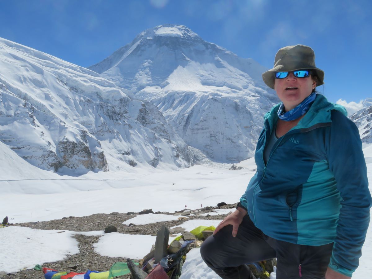
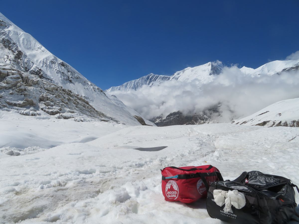
This report is split into 3 posts Italian Base Camp to Glacier Camp We’re into the sharp end of the trek today. We had an early call at 05:30, the intent is to get started early before the sun hits the slope in the valley and starts letting loose the rocks. In previous years, the […]
Dhaulagiri Circuit Trip Report – up to Italian Base Camp
This part was relatively straight forward. We slowly made our way north and upwards, travelling along valleys. There was a lot of up and down and a few diversions, but nothing was too difficult. Apart from me falling into a river! This report is split into 3 posts Darbang to Sibang An early start today, […]
Dhaulagiri Circuit Trip Report – getting to the start
This trip was originally booked for October 2020. But we all know what happened that year! It moved first to 2021 and then finally to 2022. We were a go. The trip was picked based on providing skills needed to get to my long term ambitions. I don’t know if I will end up climbing […]
Operation Fitter Rachel: Sept
Yes, another month with improved motivation. Not perfect, but getting there. The numbers 23 activities. (+3, some great quality sessions) 37 hrs (- 11. back to more normal parameters in events, no 12 hour walk in there, up 10 on Jul) 101 miles. (-27, again not skewed by a 35m event, so therefore in line […]
Operation Fitter Rachel: August
August was better than July, definitely in motivation. Felt I was back on the plan and starting to see results of training coming through. The numbers 20 activities (-2 but all quality, not just to and from gym/work) 46 hours activity (+19 hours (although slightly exaggerated due to one event) 128 miles (+57) Not every […]
Operation Fitter Rachel: July
July was basically a disaster when it came to training. And I think that is obvious as I’m only now just writing about it. Travel, illness, trainer being on holiday, all conspired to drive away any mojo and determination I had.. And that’s just not good enough. Thankfully August is turning out better, but that’s […]
Operation Fitter Rachel – Month 2
Definitely not the best of months. A number of routine changes through me off my plan..something I need to work through, as I can’t have that happening again. The Numbers 30 recorded activities (+1).  9 walks, 14 runs, 6 strength sessions 27 hours of activity (-1) 63 miles (-7) The month started well, with a […]
Operation Fitter Rachel – the road to Aconcagua
My first report on OFR. I started off calling this Operation Fit Rachel…until it was pointed out as I’d just ran a marathon I wasn’t exactly unfit, so Fitter it is.  But it’s all relative. I may have had the stamina and the mental stubbornness to plod around 26.2 miles, but I was still getting […]
Race Report – London Marathon 2019
After a few years failing at the public ballot and instead marshalling on the course, this year I got into the London Marathon through the marshalls ballot – a number of places are offered to the groups that volunteer. As the decisions were not known until January, it’s not for everyone, but as I was […]
Trip Report – Lessons from Kilimanjaro
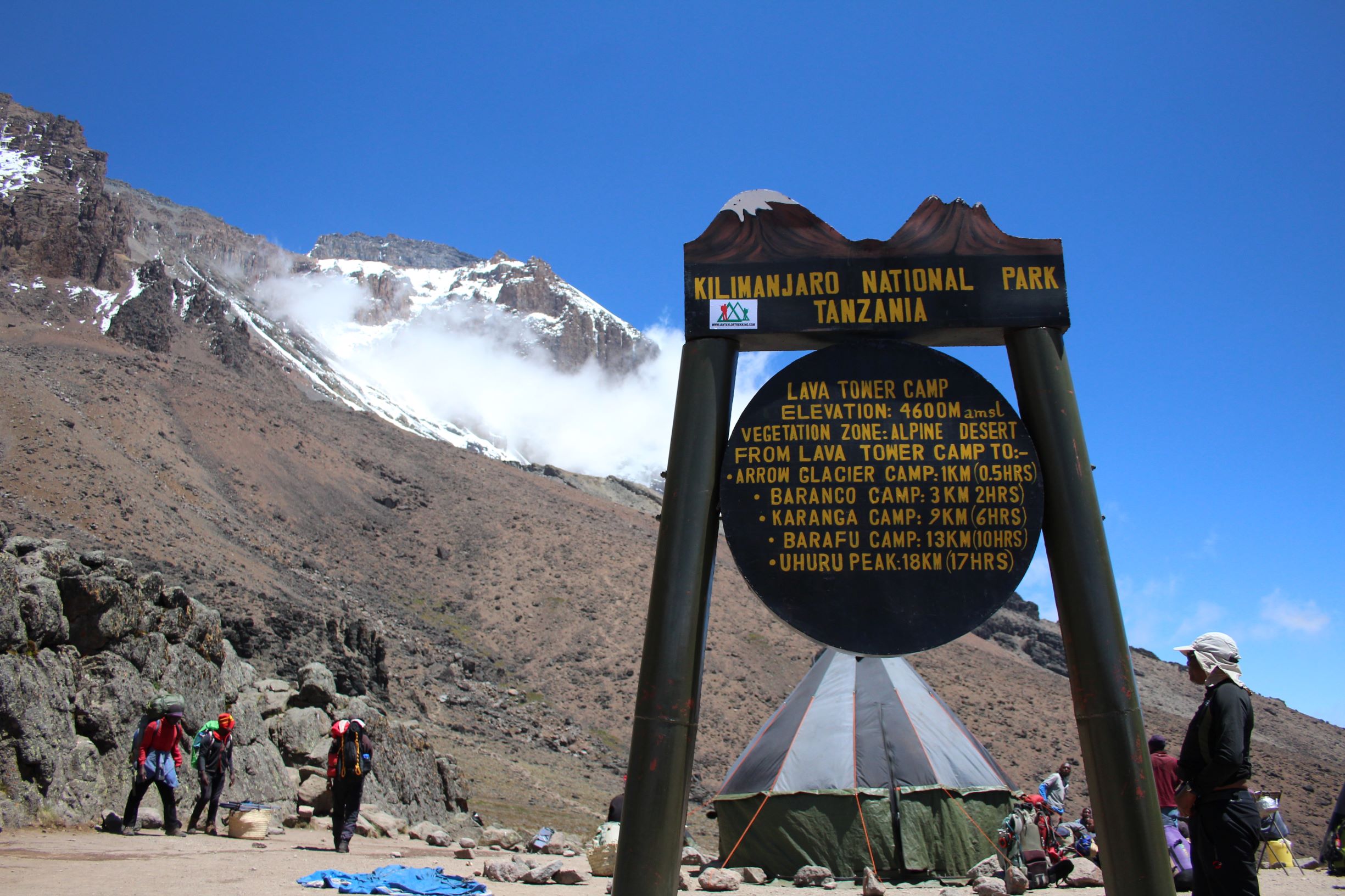
In February 2019, I took the trip to Tanzania to attempt to trek up Kilimanjaro. One of the largest freestanding volcanoes in the world (as it says on the sign) and definitely the highest mountain in the continent of Africa, at 5895m, the trip would take me higher than my Everest Base Camp trek. This […]
Trip Report – Climbing Kilimanjaro: Part 2
In February 2019, I took the trip to Tanzania to attempt to trek up Kilimanjaro. One of the largest freestanding volcanoes in the world (as it says on the sign) and definitely the highest mountain in the continent of Africa, at 5895m, the trip would take me higher than my Everest Base Camp trek. This […]
Trip Report – Climbing Kilmanjaro: Part 1
In February 2019, I took the trip to Tanzania to attempt to trek up Kilimanjaro. One of the largest freestanding volcanoes in the world (as it says on the sign) and definitely the highest mountain in the continent of Africa, at 5895m, the trip would take me higher than my Everest Base Camp trek. This […]
A weekend in Garmisch Partenkirchen
As the year slips into autumn, I thought it was time to get back out into the hills. After some time spent looking at options, whether to fly or not, whether to drive, I decided on a visit to Garmisch Partenkirchen, just a 3 hour train journey from Nuremberg. It’s got mountains and lakes, hills […]
EBC Trek: Back down to Lukla
After all that effort making our way up, it was a lot quicker getting back down to our starting point. Friday 23 Dec The best views of Everest from this valley are from Kala Pattar; watching the sun rise over the mountain was the plan for the morning. But not for me. I decided that […]
EBC Trek: Everest Base Camp
We were nearly there..one more trek. Thursday 22 Dec Today was the big day, our final ‘uphill’ day. We had one of our earliest starts, up at 5:30, out the door at 6:30 as dawn was breaking. Off we went, heading to Gorek Shep; minimal plants, moss and lichens with occasional grass clunps. Glacial moraine, […]
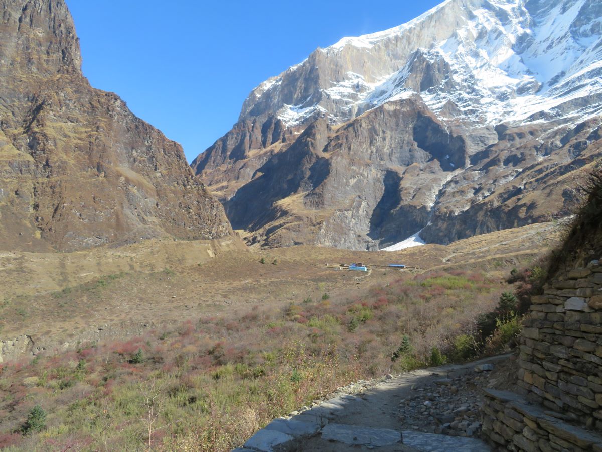
 Himalayan Valley
EBC Trek: Namche Bazar to Lobuche
I’m guessing by the time I finish this report on my Everest Base Camp trek it’ll be a year old? Anyway, let’s start this again. When you last read an installment, we’ made it to Namche Bazar and had just finished our first acclimatisation day. Next we were heading further up the valley. Sun 18 […]
Kathmandu to Lukla to Namche Bazar
Other reports for this Trip: Starting the trip and my time in India Namche Bazaar to Lobuche Everest Base Camp Getting back down Despite having little to do on my first morning in Kathmandu, my body clock still woke me up at 6:30am, which was probably a good idea given the next few weeks of […]