Half Notes 2023 H2
Right, I’m really not doing a lot of this blogging, am I. But for my own record, here’s what I got up to in the 2nd half of 2023.
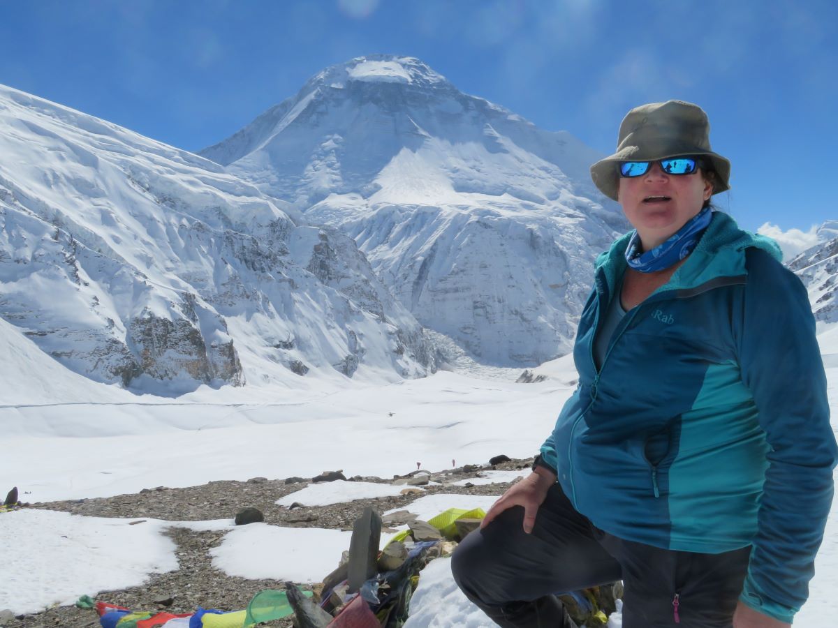
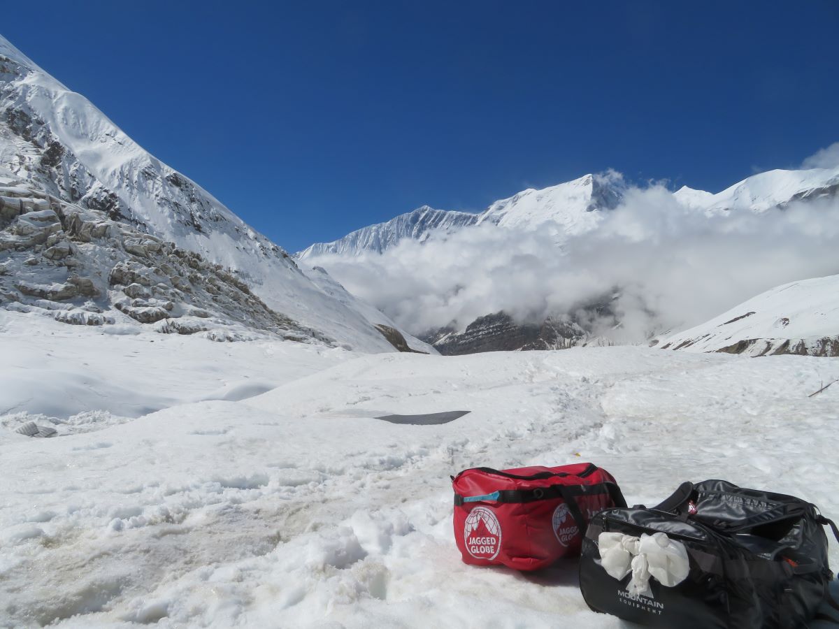
Dhaulagiri Circuit Trip Report – over the French Col
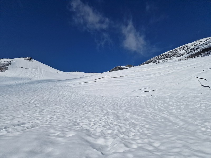
This report is split into 3 posts Italian Base Camp to Glacier Camp We’re into the sharp end of the trek today. We had an early call at 05:30, the intent is to get started early before the sun hits the slope in the valley and starts letting loose the rocks. In previous years, the […]
Dhaulagiri Circuit Trip Report – up to Italian Base Camp
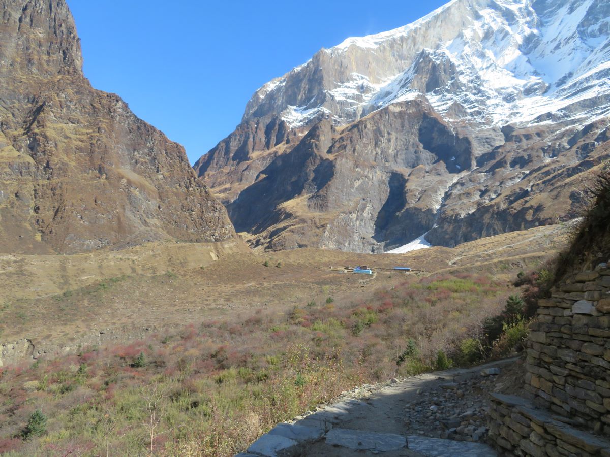
This part was relatively straight forward. We slowly made our way north and upwards, travelling along valleys. There was a lot of up and down and a few diversions, but nothing was too difficult. Apart from me falling into a river! This report is split into 3 posts Darbang to Sibang An early start today, […]
Dhaulagiri Circuit Trip Report – getting to the start
This trip was originally booked for October 2020. But we all know what happened that year! It moved first to 2021 and then finally to 2022. We were a go. The trip was picked based on providing skills needed to get to my long term ambitions. I don’t know if I will end up climbing […]
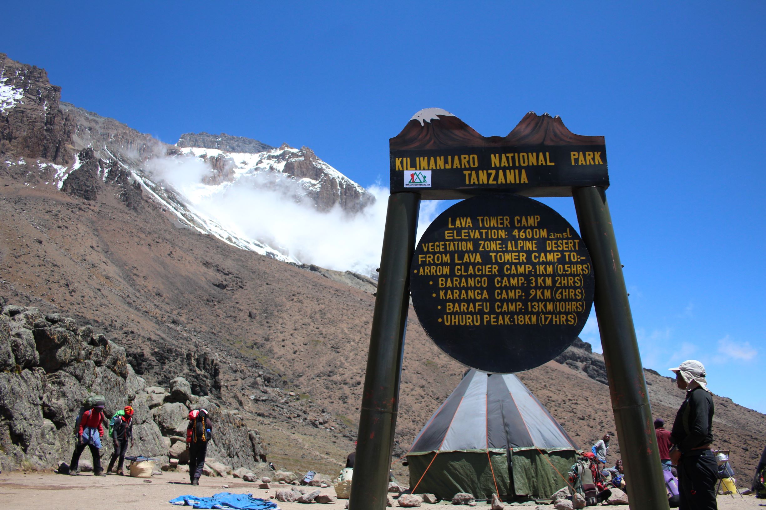
Trip Report – Lessons from Kilimanjaro
In February 2019, I took the trip to Tanzania to attempt to trek up Kilimanjaro. One of the largest freestanding volcanoes in the world (as it says on the sign) and definitely the highest mountain in the continent of Africa, at 5895m, the trip would take me higher than my Everest Base Camp trek. This […]
Trip Report – Climbing Kilimanjaro: Part 2
In February 2019, I took the trip to Tanzania to attempt to trek up Kilimanjaro. One of the largest freestanding volcanoes in the world (as it says on the sign) and definitely the highest mountain in the continent of Africa, at 5895m, the trip would take me higher than my Everest Base Camp trek. This […]
Trip Report – Climbing Kilmanjaro: Part 1
In February 2019, I took the trip to Tanzania to attempt to trek up Kilimanjaro. One of the largest freestanding volcanoes in the world (as it says on the sign) and definitely the highest mountain in the continent of Africa, at 5895m, the trip would take me higher than my Everest Base Camp trek. This […]
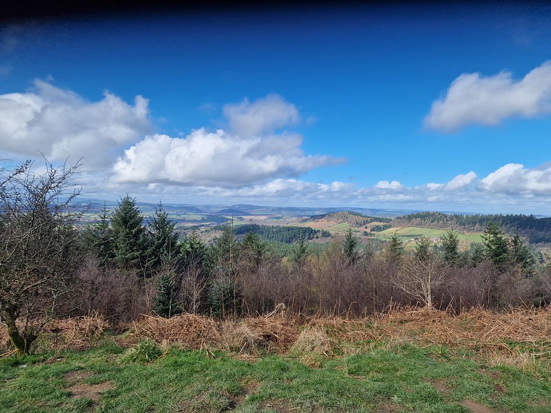
A weekend in Garmisch Partenkirchen
As the year slips into autumn, I thought it was time to get back out into the hills. After some time spent looking at options, whether to fly or not, whether to drive, I decided on a visit to Garmisch Partenkirchen, just a 3 hour train journey from Nuremberg. It’s got mountains and lakes, hills […]
EBC Trek: Back down to Lukla
After all that effort making our way up, it was a lot quicker getting back down to our starting point. Friday 23 Dec The best views of Everest from this valley are from Kala Pattar; watching the sun rise over the mountain was the plan for the morning. But not for me. I decided that […]
EBC Trek: Everest Base Camp
We were nearly there..one more trek. Thursday 22 Dec Today was the big day, our final ‘uphill’ day. We had one of our earliest starts, up at 5:30, out the door at 6:30 as dawn was breaking. Off we went, heading to Gorek Shep; minimal plants, moss and lichens with occasional grass clunps. Glacial moraine, […]
 Himalayan Valley
EBC Trek: Namche Bazar to Lobuche
I’m guessing by the time I finish this report on my Everest Base Camp trek it’ll be a year old? Anyway, let’s start this again. When you last read an installment, we’ made it to Namche Bazar and had just finished our first acclimatisation day. Next we were heading further up the valley. Sun 18 […]
Kathmandu to Lukla to Namche Bazar
Other reports for this Trip: Starting the trip and my time in India Namche Bazaar to Lobuche Everest Base Camp Getting back down Despite having little to do on my first morning in Kathmandu, my body clock still woke me up at 6:30am, which was probably a good idea given the next few weeks of […]
Travel: A trip to India
After 6 months of preparing, getting equipment and trying to get fit, my trip to India and Nepal was ready to go. Rubbish was put out, heating turned down, everything washed up and the final elements added to the suitcase. it was time to head off for 3 weeks, my first Christmas and New Year […]
A trip to Gloucester
After spending the first day of my bank holiday weekend in Worcester, on the Sunday I explored the town of Gloucester. A day similar to the previous in that it took in Cathedrals and museums. First of all was Blackfriars Priory, founded in 1239, dissolved in 1539 and bought by a local alderman who turned […]
A trip to Worcester
This was the first half of my weekend away, a chance to go and tick two cathedrals off my list. Worcester is only 40mins by train from my base in Gloucester, but trains were only every 2 hours, so I had to make sure I kept to good timings. I was hoping to take a […]
An F1 Pit Lane walk
Canada is one of the few F1 circuits that offer access on the Thursday before the race meet starts. You don’t even need to have a race ticket to access the track. So off we went to hang around the pitlane for 3 hours – along with a lot of other people! But it was […]
On the train to Montreal
Wednesday was another travel day. I met up with Sofia at the train station and we jumped on the 5 hour trip to Montreal. Definitely not as much beautiful countryside as out last train trip (Prague to Budapest) but pleasant enough. The plane trip itself would have been cheaper (we went business), but when you […]
Some time in Toronto
The day started with coffee and chat. Gaming, game design, trademarks, AI, the future of humanity, startups, population growth and Malthus. Just your everyday small talk 🙂 A great chance to talk about different things, that I don’t have chance to think about in my everyday job. Next, off to the airport for my next […]
New York and New Jersey
It’s another holiday! This time to the continent of North America, with a combined trip to New York, West Milward (In New Jersey), Toronto and Montreal for the F1. An easy trip to Heathrow and all the way through the security ended with a slightly worrying beep of the machine as I went to board. […]