This report is split into 3 posts
- Getting to the start
- The trek to Italian Base Camp
- Over the pass and down (this one!)
Italian Base Camp to Glacier Camp
- 4.6 miles
- 4.25 hours elapsed
- 800m total ascent (with 210m descent)
- Max elevation: 4185m (+575m)
- Toilet tent/hole in ice
- Dinner: Soup, rice/potato/tomato sauce, pineapple
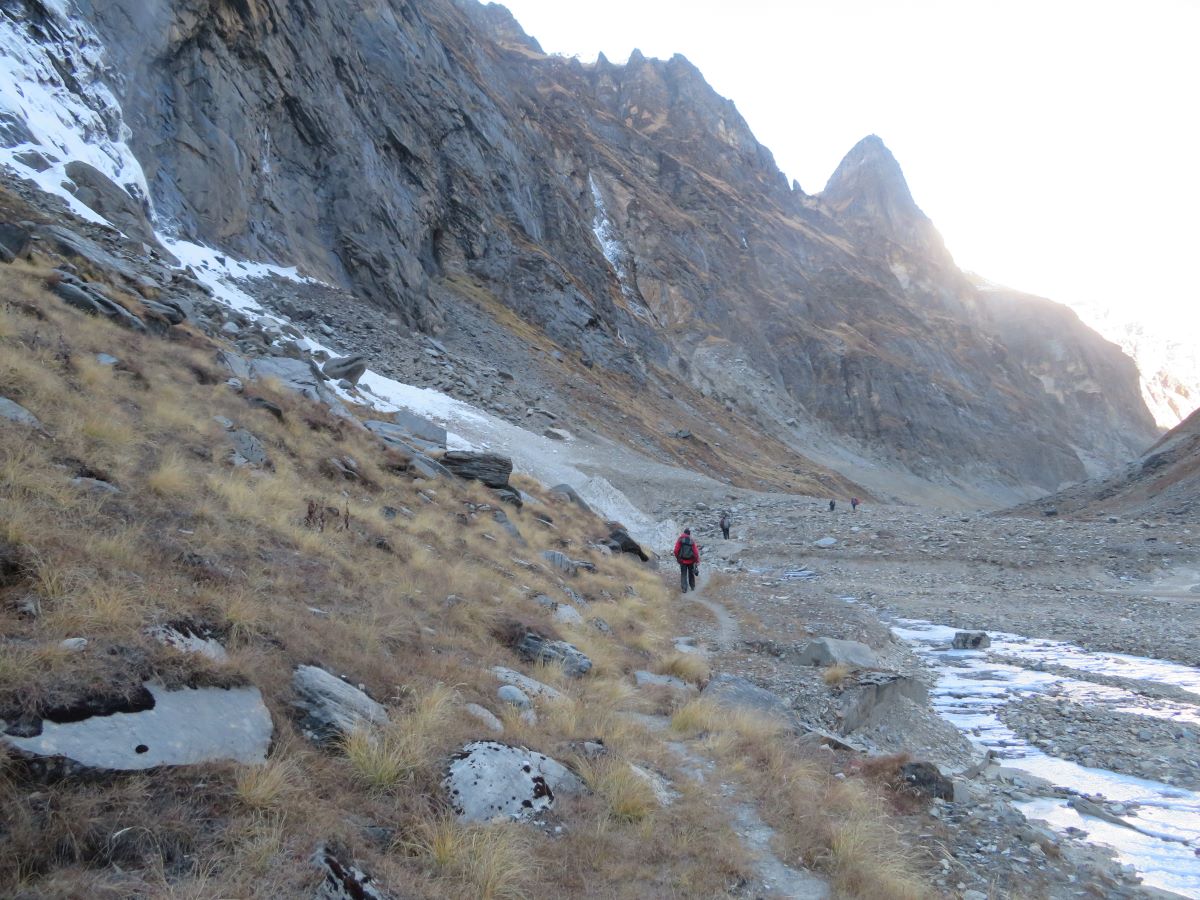
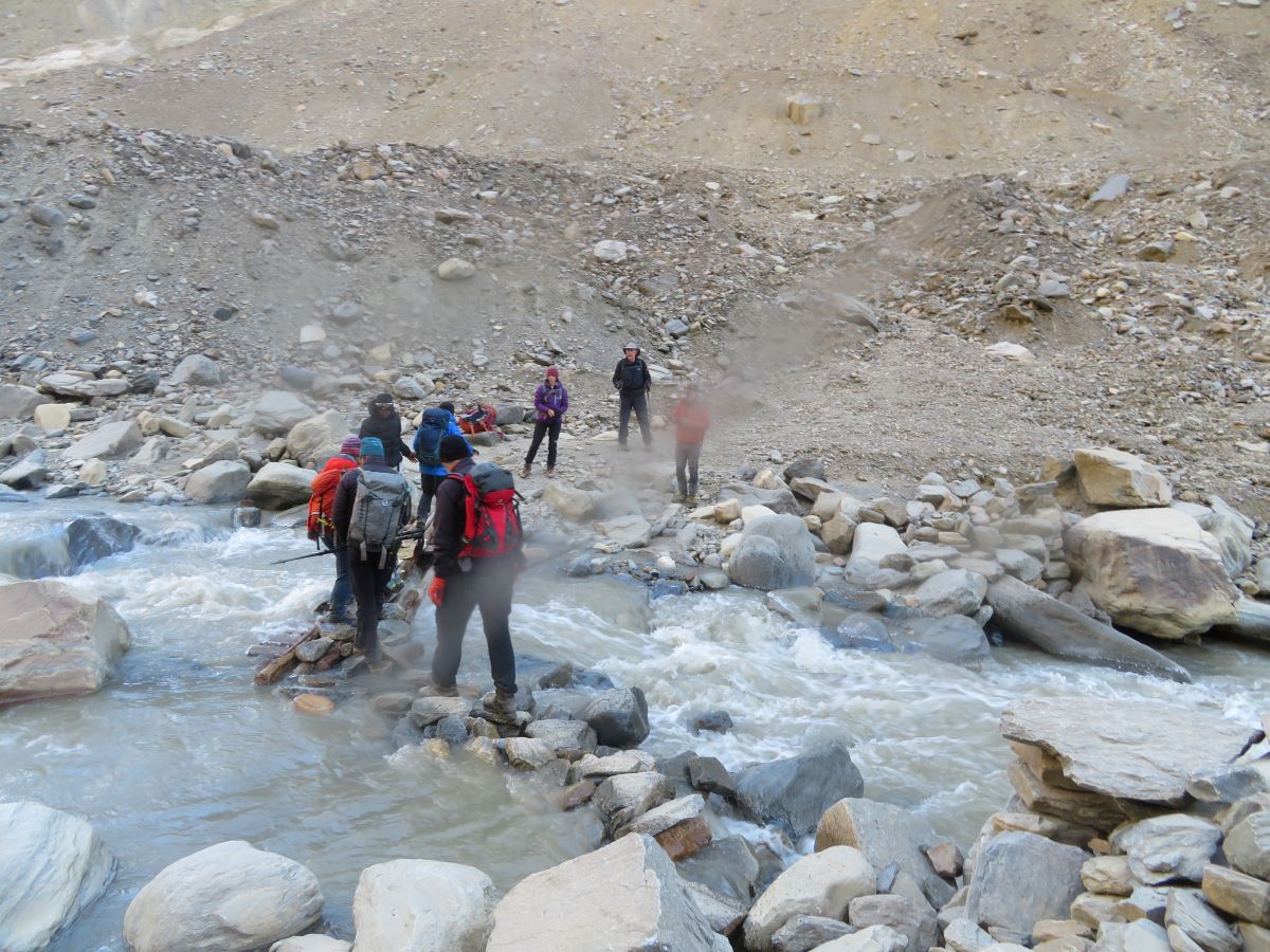
We’re into the sharp end of the trek today. We had an early call at 05:30, the intent is to get started early before the sun hits the slope in the valley and starts letting loose the rocks. In previous years, the route went up from the camp and across the glacier at a higher level, before crossing the river to the left hand of the valley. This has no change and we head down to the bottom and cross just above the end of the glacier and then climb directly up the side of the valley. This was not a great walk, landslides meant that the path was precarious and a lot of steps had to be kicked into place; there were a number of places where the exposure was high and a lot of care was needed. It was bad enough for us – the porters needed additional help in places as they had to carry their loads across the route. It got a lot better once we were into the valley; there were still bits of up and down as we went over the debris from rockfall and landslides, but it was a more gentle ascent, with a few river crossings needed. We had one very near miss, when a football sized rock came rolling down the hill between the team, missing by about 10m.
We eventually got to camp around 11am; a very different place, lots of rocks, with some snow in between. The tents were placed in cleared flattened spots, not really close together. Luckily there were enough spots and no new ones needed to be cleared. The tents were finally installed after lunch, as the some of the porters were behind us. I spent most of the day in the tent reading – it was the warmest places as you definitely needed layers to be out and about

Glacier Camp to Dhaulagiri Base Camp
- 4 miles
- 4.75 hours elapsed
- 520m total ascent (with 40m descent)
- Max elevation: 4675m (+490m)
- Toilet tent/hole in ice
- Dinner: Soup, rice/dal/beef jerky curry, mixed fruit

Back to our usual 6am call and then out marching off for 07:30. Today was a steady trudge up, with snow underfoot from the beginning. Easy to deal with at the start of the day when frozen, but harder going as it warmed up later. It was a very steady pace for me, the breathing was fine but the limiting factor was my legs, they had definitely reached a limit of up today, with the hips/glutes feeling really tired. There was no need to stop and rest them, I just kept plodding, but it was just tiring.
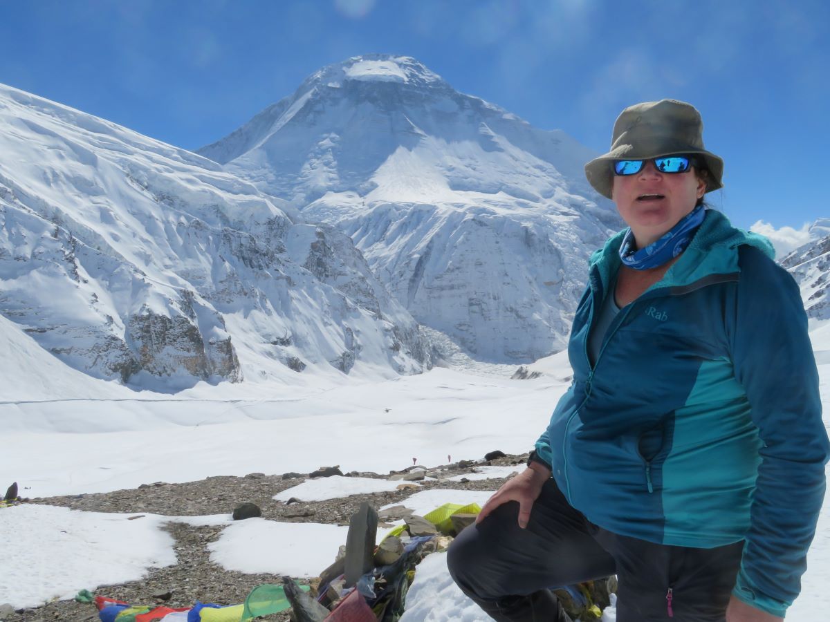
When we got to base camp, it was a mess. Around 2m of snow in places, much of it covered abandoned kit from the mountain expeditions. The guides and porters managed to dig out a few useful things and I got a total bonus – a TENT MATTRESS!! It was on top of the snow (I assumed one of the other trekking groups had left it there) and I grabbed it and dried it out before bringing it into my tent for the 2 nights we were staying. Oh, it made such a different, about 2 inches of foam providing insulation making it a very comfortable residence, even if it never quite reached lovely tent sauna temps as it was generally cold and windy, and every now again a bank of clouds rolled over camp, just blotting out the sun.
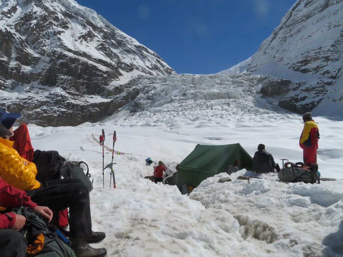
On day 2, I decided not to do the acclimatisation walk and rest my legs – just stretching. I was not intending to do the mountain, so it was less important for me to go higher in prep. It was warmer, with less wind and less cloud later on.
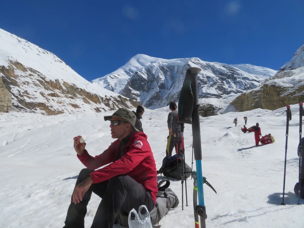
Dhaulagiri Base Camp to Hidden Valley
- 5.25 miles
- 8.5 hours elapsed
- 605m total ascent (with 250m descent)
- Max elevation: 5380m (+705m)
- hole in ice (no tent today…just a tiny snow wall)
- Dinner: Soup, spaghetti bolognaise, pineapple

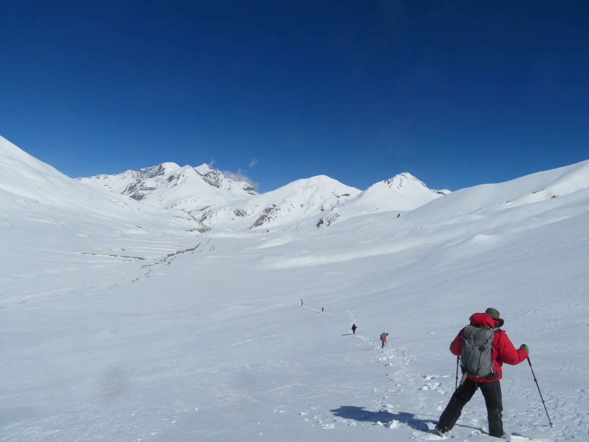
Today was the biggest planned day – up over the French Col, the highest point for me – and then down to the Hidden Valley. Overnight, we’d got down to about -13c, so it was a chilly start. A quick breakfast, a camp breakdown and away we went. We were walking on deep snow, on a very narrow route that had been compacted by previous trekkers, only about 6 inches wide in general. Any steps too far off the path and down you went, to your knees or your hips. It made for very slow going.
First stage was to head out of camp, on the opposite side of the valley to Dhaulagiri, away from the avalanche zone. After about 2 hours, we headed up the wall of the moraine away from the glacier, but still on deep snow. First steep climb done, we could see our “summitâ€, the top of the French col but still a bit to go along the crest of the moraine and then up to the top of the Col. This took another 4 hours for the 2 miles (with breaks). A this point we cam across the donkeys – 2 live ones and quite a few dead. They’d been used to get kit up to base camp for the expeditions but had been abandoned with the heavy snow 2 weeks before, there was no way to get them back down apparently. So they died – I had no idea how 2 were still alive but there was nothing we could do
Now it was supposed to be an easy stroll to camp, taking about an hour, down from the coll and through the valley. Easy to was not, it felt like a never ending trudge through slushy snow – although looking at the times it was only about 2 hours, it just felt a lot longer. The relentless sun meant everything was just bright and undifferentiated and at this point, my mind was definitely not having fun, it was like I was in perpetual déjà vu, saying something and then not sure if I had said it or repeated it. We made stops for food and drink and I was fine then, just the endless trudging, looking at nothing but the feet to judge where to go meant my mind felt like I was disassociating. When I did see the tents, I wasn’t 100% sure we were actually there, given how many times I’d hoped to see them.
I made my way to the dining tent and immediately burst into tears. Five minutes later I was fine, but this was a huge emotional release of making it after what had been a horrible few hours but felt a lot longer. I wasn’t the only one upset, there had been a lot of effort by all in getting to this place.
At this point, we had no sleeping tents, no gear and the kitchen had only just got water – they had to travel 300m to get water supply. Porters were still spread out over the mountain and slowly trickling in. They were doing an amazing job but almost everyone was having a bad day.
The kitchen team pulled out a miracle and we got fed and watered. They continuously managed to create amazing meals in challenging circumstances. Over dinner, we discussed the next day. The other 7 of the team were due to climb Dhampus, but at this stage, 4 decided it was not for them, they had enough, especially given the expected conditions of deep snow. Phil, Tommy and Kathryn were ready to go for it – so they planned a 4am start.
The other decision made was that we would skip the next camp, which was only a few hours away, and pull out a really long day to head towards where we would have lunched the following day, which was a lot further down and below the snowline
Everything was late running today, but we got to bed rapidly after dinner. Unfortunately for me, my bad times had not ended – my airbed had developed a leak. More miracles – Phil came to the rescue and managed to find the puncture so was not going to be sleeping without insulation on the snow. I was very happy with this given it was -21c overnight. One final issue – I’d not renewed my suncream and overnight, the sunburn came out, which made it an uncomfortable last few days.
Hidden Valley to Yak Karkha
- 11.25 miles
- 12.5 hours elapsed (approx., no watch for last time)
- 1100m Descent, to 4300
- A stretch of dirt – not even a hole dug!
- Dinner: Soup, pasta/sausage/veg/, peaches
I could hear the peak team leaving around 5, the rest of us had an 6am call. Everything was slower today, with breakfast not quite there. It was very cold, but the team leads were also not there and you could tell. Breakfast become quite funny, when everything frozen. First the spoons froze to the bowls; then the toasted bread literally froze on the plate, it was still about -15c. That was not finished!
Normally, we’d be finishing breakfast and things would have been packed around us, but again, a lot slower. But this could be expected given a lot of the porters gear was still frozen – as the sun came up, they were trying to defrost their boots. Things went a lot quicker once the cook team had lit a fire, they could defrost their boots there. I knew how long a day it was going to be, so wanted to get moving, we were all ready. But plans had obviously changed, instead of going with the guide, we were waiting. Two figures appeared over the horizon, trekking towards us. Chris and Dawa had come back, ready to lead us on. Pasang, Phil, Kathyrn and Tommy were carrying on up the mountain. Now we saw some action and finally started. The first 2 hours were gently (and then steeply) uphill, over Dhampus pass. Every now and again we’d get a glimpse of the 4 figures up the hill. Over the pass and we headed down for a bit, passing where we would have been camping on the original schedule. We were still trudging along the very narrow passable “solid†snow with constant sinkings to either side, which meant continuously concentrating on where the feet were placed. I’d borrowed a paid of mini-crampons and they helped a lot – I need to get my own pair for the next time I’m in these conditions.
Looking up, we could see the team had split; 2 were sitting waiting, 2 heading on up further. But they could not get all the way up in the agreed time; they needed to turn around and come back down. Phil had made the attempt, with Pasang, but it was not to be. They caught up with us around 12:30.
At this point, I thought we would have been heading down more, as we knew we had a lot of descent to do. But not on this path, we spent a lot – A LOT – of time traversing slopes, around the ridges and outcrops. This was supposed to be a not too bad path, but the snow just made it worse. There was a lot of having to kick in steps, to keep your footing, just to find somewhere to step. It was hard work; I slipped a few times, but arrested myself quick enough, even if I ended up bending the walking pole enough not to be fixable! Only a few places were objectively dangerous where you would not want to slip, most of the time it was a fairly gentle slope. This is where my lack of speed did cause an issue. It was a long trek, I was tired and I was slowing down. As the day wore on, we started walking through clouds and at this point my ability to assess footing was severely reduced, the flat light meant I couldn’t tell whether a foot placement was level or sloping, it was just flat white. There was some of this in the bright light, but it was a lot easier. I was also getting some of the same weird brain dissociation as the day before. It was also obvious some of the porters were in difficulty on the slopes with their luggage and the guides were back and forth helping them on some slopes. After 9.5 miles we finally got to a place where we could see down into the next valley – we had made it. Nearly. There was another 1.75miles, 90 mins or so and 800m of descent to go, down a dirt path. The sun was setting as I got to the top of the hill and it was dark when I got to the campsite. A reason to always carry a head torch. I was now only with Dawa, who had given his headtorch to one the guide who was heading back up the hill to find the rest of the porters – we were still 3 down at this point. Mentally I was in a lot better place than yesterday, physically I was a lot more tired, it had been at least 12 hours on my feet.
The camp was still being set up, the dining tent just a shelter, with no seats and our personal tents were not ready, some were still up the hill. Finally, everyone arrived and things slowly got sorted. Food arrived but for the first time none of us could really finish it. The cook team had done a miracle again and we all felt really bad that none of us were quite able to eat it all, we were all tired.
We eventually got to bed after 9, all of us carefully walking around the campsite to avoid the mix of animal and human faeces – it was not a nice clean campsite. Our group added some to it – there was no toilet tent or hole in the ground today. But a better night sleep was promised, we were warmer and lower down.
Yak Karkha to Marpha
- 5 miles
- 3.25 hours elapsed
- 1600m Descent, to 2650
- Nepali toilet
- Dinner: Soup, pasta/greens/sauce, Pineapple. BEER!
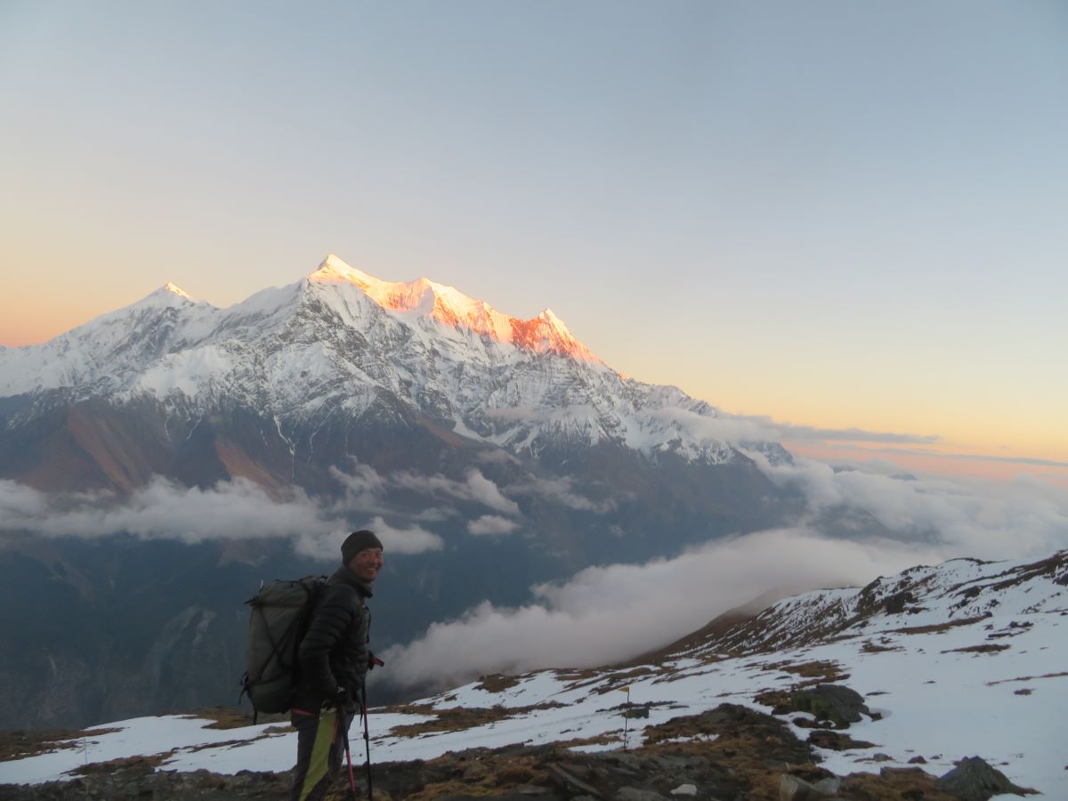
Yesterday was horrible but it was definitely the right decision. We had a late call (8am), a most magnificent breakfast view and only a half day walk ahead. Although it was not going to be the easiest for me, it was all about the down, 1600m is a long descent. I took it easy as the path was rough and I needed to take care to avoid missing steps. My challenge is I know I can improve my up and traverse speed, but down speed is going to be a problem as I literally can’t tell the state of where I am stepping, the distance of the down step or the level of the slope.
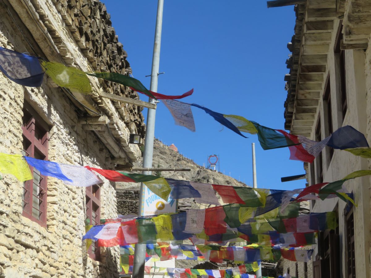
We hit Marpha around noon and it was lovely! A very tourist friendly main street, with shops and cafes and flags. We wandered along it, eventually heading out a little for our lodgings for the night. We were camping in the garden of a tea house, still using our kitchen team. Tents took a while – the porters were obviously having an easy day and I can’t blame them after yesterday. After lunch, some headed into town. I decided a hot shower was worth the 200 rupees, although I think I was the only one.
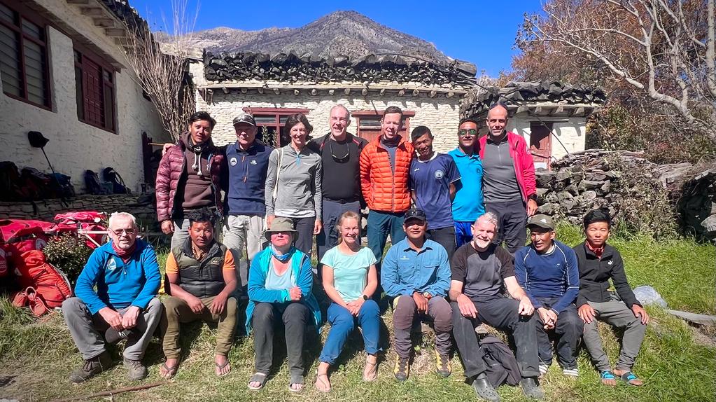
Things were laid out to dry and we sorted out the money for the tips, tonight was the last night for the porters. We all gave a little extra – they had worked very, very hard under challenging conditions. After dinner, they came in (well, nearly all, one had obviously had a little too much local drink). There was a speech by Chris and Kathryn added a few words in Nepali and then we were done.
Getting back to Kathmandu
The last few days provided a whole lot of interesting travel setbacks. The original plan was to leave Marpha early and head up the prad to Jomsom, check into a lodge and then fly out the following day, to Pokhara. But the first problem was accommodation in Jomson; whatever the original plans were, this was not happening and they could not find somewhere where we could do our own cooking (or rather, have the team cook). So no morning walk, we stayed around Marpha for the morning and then had the lunch back at the accommodation. We had a great treat for lunch – fried chicken and greens! We said goodbye to the cook team now and headed out; unlike Chris’s previous visit this was not a trekking track, but a road all the way up. Not that pleasant a walk and when we got to Jomson, the immediate reaction was not as nice as Marpha.
Next issue came with a phone call – there was no plane! The one we were booked on was grounded and the flight would not be happening. We were installed in a teahouse for a drink whilst Dawa worked his magic and sorted out two 4WD vehicles, after lots of calls. No easy afternoon for us. The bags (which had been delivered to Jomsom in a truck) were loaded up on top of the vehicles and we split between them. It was after 4 by the time we were leaving Marpha again and we had at least 3 hours drive ahead of us to get to Beni, our planned stop. The trip was not too bad at the start, a mix of paved sections with some slightly rougher bits. But as we went further, and it got darker, the road got worse. And worse. And a bit more worse. Almost all unpaved but also hit with a lot of landslides. The drivers did an amazing job of getting us there, but it was not the most comfortable of drives. I’m not sure whether it was better in the light (where I could see the drops to the river) or the dark, when I couldn’t). Every now and again we met a bus coming the opposite way, often requiring some gentle manoeuvring to get past safely.
We got to Beni and our hotel for the night; the restaurant was a little Fawlty Towers like, with many, many mistakes in the orders, but we all got fed in the end. Up early the following day for about another 3+ hours on the road. Only the first hour or so was poor, then we got onto better roads. We had lunch next to the airport and said goodbye to Tommy and Kathryn who were staying in Pokhara. Finally, we got on a plane to Kathmandu, getting to our hotel for about 19:30.
We had one full day left, so I booked a massage and a facial and then went out for a lovely Japanese lunch. For dinner that evening, we headed out to Dawa’s restaurant, which was not yet officially open but was in soft launch. An excellent local meal with local beer 😊
Overall, I loved this trip. There were a few moments of terror, but nothing really that made me question why I was doing it, as there had been on previous trips. You absolutely needed to have had some experience of similar trips and environments I think to get the most of it – I would not recommended it if this is your first time in the mountains without any trekking or campaign experience.
Reflecting on the trip.
I went on this trip to continue to get experience in mountain environments and of multi-day campaign trips. I got both of them in spades so it hit all of those needs. But I also have more work to do
Fitness! I’d worked hard over the summer on uphills, especially after some issues on the mountaineering course early this year. I was a lot better than then but there is still so much more to do. I am not fast and I have to build more speed into my uphill walking.
- The training plan has been roughly mapped out for the year
- I have weekends booked every month in Wales to get more hills
- I am trying to be more accountable in doing ALL the planned sessions
Agility. This is a downhill issue. I will always have issues given eyes and lack of depth perception but I think I can improve my speed by working on balance and flexibility, so that when I do miss my step I am better prepared to deal with the instability
- I am adding yoga to my plan
- I am working on balance exercises
Self-Reliance and kit. A stupid mistake not to have the airbed repair kit with me.
- More thinking and planning about what is needed – making sure I have all the spares built in. It’s a lesson learnt and won’t happen again
- Micro-crampons. I had never seen or heard of these. I’m getting a set and taking a deeper look at various kit that can be used.
Mountain Skills. There were things I had never done before
- Traversing. I have very little done of this so the skill of kicking out steps had to be learnt in the walk – which given the situation we were in was not the easiest. I need to look for opportunities to build these skills.
- Climbing was not needed for this, but will be for future trips. I am adding this to the plan, having started indoor sessions and looking to add some outdoor stuff next year.
For the full set of pictures, see Flickr