This part was relatively straight forward. We slowly made our way north and upwards, travelling along valleys. There was a lot of up and down and a few diversions, but nothing was too difficult. Apart from me falling into a river!
This report is split into 3 posts
- Getting to the start
- The trek to Italian Base Camp (this one!)
- Over the pass and down
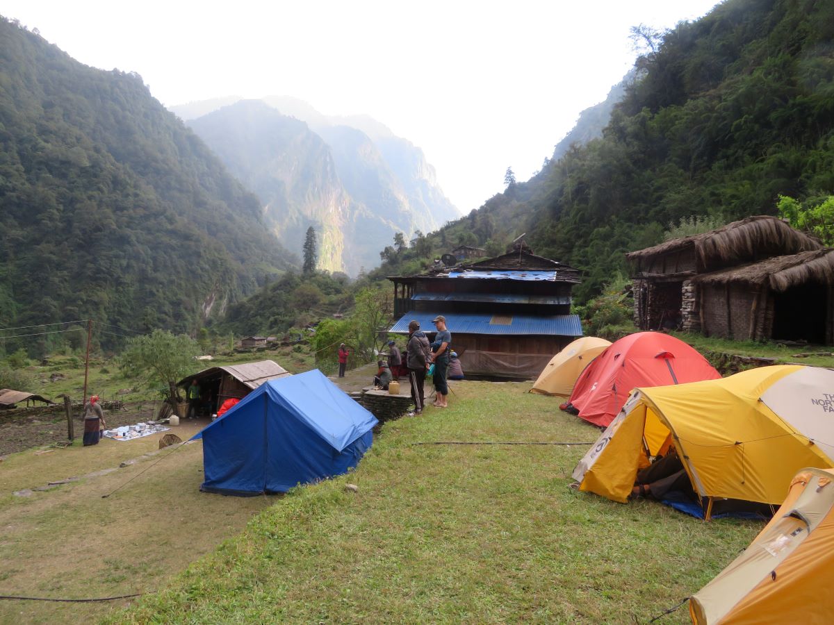
Darbang to Sibang
- 7.7 miles
- 6.5 hours elapsed
- 1000m total ascent (with 331m descent)
- Max elevation: 1075m
- Toilet: Toilet tent/hole in ground
- Dinner: Soup, Chicken curry and mixed fruit.
An early start today, I think the earliest we had across the whole trip. A 0530 knock on the tent with a cup of tea and a washing bowl of warm water. We got tea and water across the whole trip when we were in the tents. We were needing to head off early as the playground was going to be used for more drilling – and this was our first morning, so they were allowing more time to sort ourselves out.
We rolled out of camp around 0720 and took the road. It was a road a the start, we had to keep out the way of buses, 4WD and lots and lots of bikes. It was a steady climb; with occasional steeper bits as we took a shortcut up a slope when the road took the longer more gradual route. At the top of every climb, around every mile, we stopped for drink and rest. Looking at the later days, they were easing us into the walking, not doing too much too early.
Lunch was had around half way – about 1030! A regular occurrence on the early days, an early lunch, only a few hours after breakfast, before dinner at 6. Across the trek, lunch was definitely the most eclectic of the meals, a mix of stuff that you may never expect. This one was quite mild – potatoes and Cheese/Onion toasties. This also established the theme for most meals – carbs and more carbs.
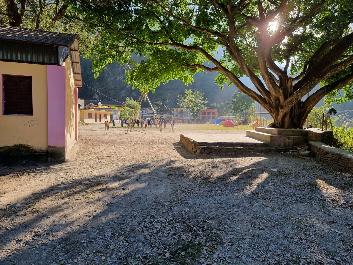
We arrived at camp just before 2, another school playing field, with a football match being planned. They were painting the goalposts and checking the pitch. Tents were put up, kit reviewed. I decided to do some washing, which obviously caused it to rain torrentially for a couple of hours. We discovered the minor issue of tents not being quite right and some leaking, something we made sure would not happen again as we always checked in the future. Although it did not rain again, it was good practice. Post dinner, taking advantage of the “warmth†we played a lot of cards before retiring around 9ish

Sibang to Jugapandi
- 8.8 miles
- 8 hours elapsed
- 1115m total ascent (with 1369m descent)
- Max elevation: 1872m (+797m)
- Toilet: Fixed toilet hut + tent/hole in the ground
- Dinner: Soup, Pasta/sauce/veg
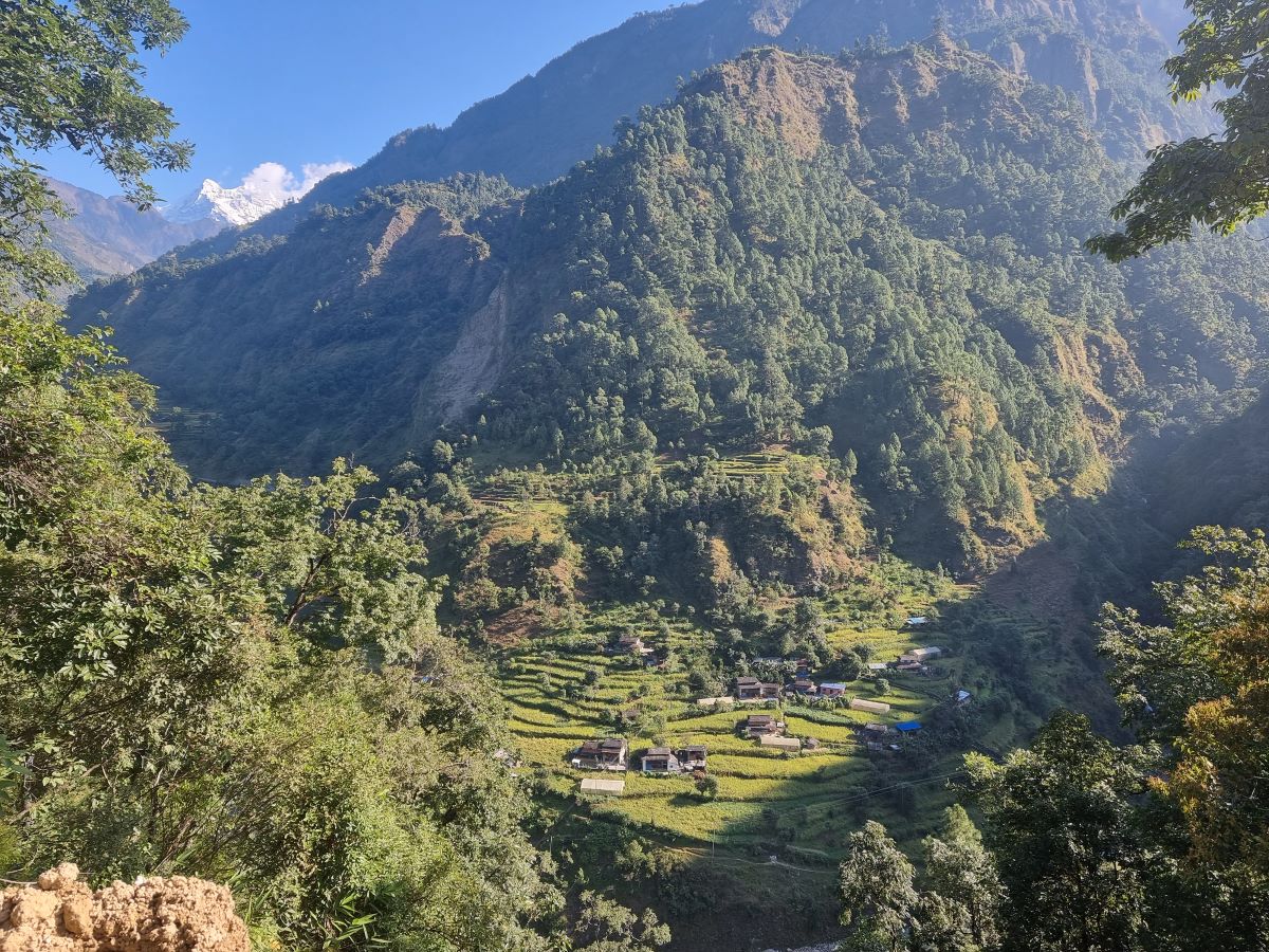
The wakeup knock was at 6, with breakfast al fresco – they’d taken down the dining tent early. Today we were going to be following a river, with a lot of up and then down in order to get over the various tributary streams. You could see the impact of the monsoon, with landslides etc. In one case, we needed to make a detour, on a different path which ended up crossing a river via some boulders. This is where disaster struck, at least for me. Long step, slippy stones and in I went. I was fine. The phone not so – cracked and soaked. Turn it off, get in in rice as soon as I could and I waited a few days to see how it was. End result – no camera (and it’s a phone sold on camera quality) and a touch screen that does not work well. It also screwed up the SIM..so needed to get that replaced when back. We carried on from this stream, up and then down. Looking ahead to the next uphill, another problem was spotted – there was no path. It had all been swept away by another landslide. Pasang was sent ahead to see if it was passable, but the answer was no. The detour was not as obvious this time, but just visible – we’d head straight up the hill where there was just about an emerging path that was developing. This took us, after a steep walking climb, up to the road, which we followed for a while before getting to the next “shortcut†path which led us over the next ridge. I did have a “tingly†moment on this hill – which meant I was not taking care of myself. Lessons learnt, it did not happen again as I made sure I was topping up food and water at each minor stop. The ankle was also playing up today (I sprained it badly in July). So bad legs, bruises, wet, boking out and a broken phone. This was just a very messy and uncomfortable day.
An early stop for lunch, but not for long, today was a pretty long day for the trek. We got to our night stop, which was a tea house, as things were being organised. There was a “proper†toilet here, it a hut with a squat toilet arrangement, but the tent was also put up for our use as the fixed facility was OK, but not brilliant. Tea and biscuits, general tent faffage (finally feeling I have the system OK) before dinner and games. Bed was around 8
Jugapandi to Boghara
- 3.75 miles
- 4 hours elapsed
- 1040m total ascent (with 676m descent)
- Max elevation: 2048m (+176m)
- Toilet: Fixed toilet hut
- Dinner: Soup, noodles/tofu/green beans/peanut sauce , peaches
The regular 6am start before heading out around 7:30. My notes say lots of uphill and lots of steps, the trails are “managed†to a certain extent and steps help us going up and down. This was a very short day, we stopped at 11:30, at a tiny village with a couple of houses and a tiny tea house. They put out a bowl of beer and Coke bottles, but I don’t think anyone bought. I spent nothing between leaving Pokhara and arriving in Marpha.
Our tents were set up on some terraces and we then had the rest of the day to relax and do chores. The first priority was to dry things, as much was still damp, including my shoes from the day before. Tents, sleeping bag and clothes were all laid out in the sun to dry off. We also had the opportunity to wash clothes and dry on a line, with running water from a hose plugged into a stream. Most importantly, I washed my hair! Cold water, but it was good to get it cleaner. It was more than warm enough to dry quickly. This started a trend and the other women did the same as did some of the men, who took the opportunity to strip for a full wash. Reading and resting for the afternoon before dinner and games. Early to bed for some more reading.
Boghara to Dobang
- 6.35 miles
- 6.5 hours elapsed
- 1878m total ascent (with 1261m descent)
- Max elevation: 2506m (+458m)
- Toilet: Toilet tent/hole in ground
- Dinner: Soup, cabbage/pasta/sauce, pineapple
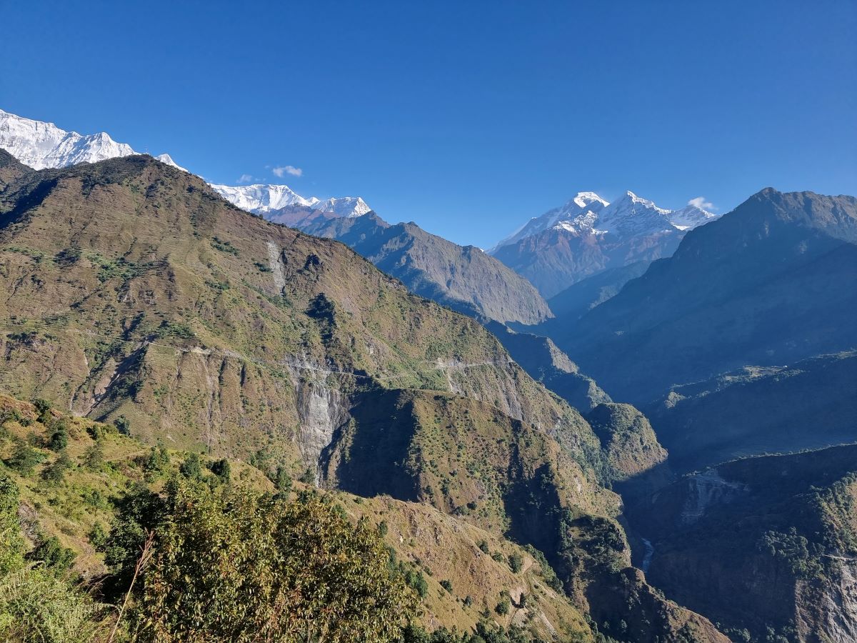
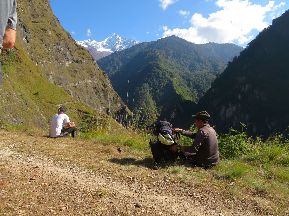
Our largest climbing day so far, with a fair bit of down recorded. These ups and downs are what the watch recorded, so every up and down, but overall the day was up, ending up 458m higher. Usual morning timings, up at 6, head out at 7:30. There was a lot of forest walking today, which reminded my of UK forests, with rough paths and lots of routes. There were far more steps though, up and down – the last few days have pushed my calfs and they’re a little sore today. We kept an eye out for monkeys – they were “promised†in the trip itinerary – but nothing was seen. I was at the head of the walk today, they were moving at my pace. Although probably slower than some would have preferred, we were still hitting the days targets for getting where we needed to be. Three hours to the early lunch spot and then another 2.5 hours , arriving about 2 in the afternoon. There was no warm sun this afternoon at camp, we were in the wrong part of the valley and the sun had moved behind the mountains. We were all feeling the chill in the air, with more layers being put on for hanging around the camp.
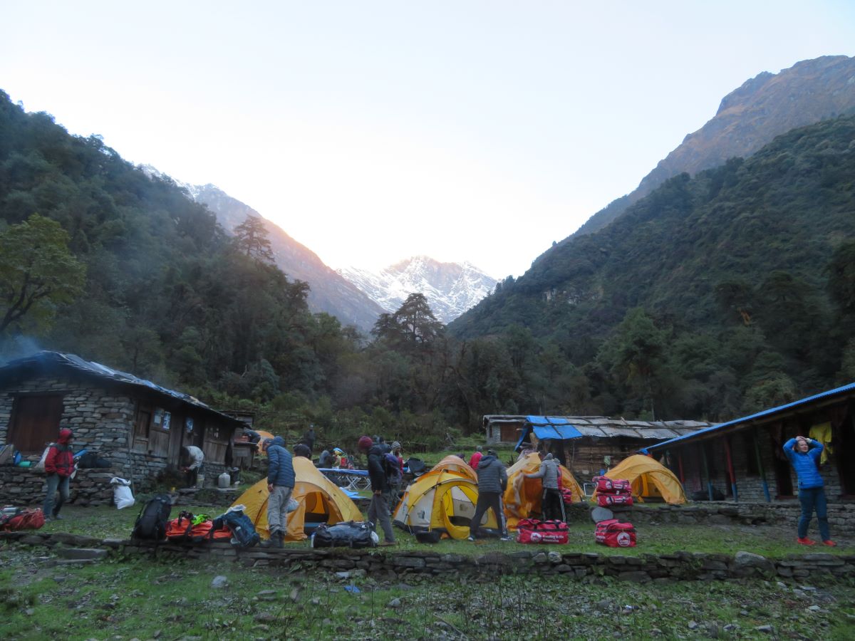
There are two other groups in the camp, both French. One had been at the same place as us yesterday but the other group were coming down. It may have been lost in trnaslations, but the information we got was that they had been stuck at Italian Base Camp with 1m+ of snow and could not go any further. That was not what we had heard so far, as we’d understood we could pass further. This news made no impact on our plans, we were still heading up. Dinner and bed for 8 tonight.
Dobang to Soligari
- 4.6 miles
- 4.5 hours elapsed
- 1410m total ascent (with 725m descent)
- Max elevation: 3160m (+654m)
- Toilet: Toilet tent/hole in ground
- Dinner: Soup, pizza (with cabbage!)/pasta/veg +peanut sauce, pineapple
The usual start to the morning, out for 7:30. It was a lot colder last night, was considering an extra layer but I did warm up in the end. We walked through a lot more forest today, starting off with broad leaves and ending with conifers; we had bamboo all the way up. It was relatively stead up with no real downs, but more undulating. Today, the group split into those that wanted to go faster – I was with the more relaxed team
We had 3 river crossing today and understandably I was apprehensive. For one I handed over my pack – we were using stones; the others had “bridges†although one was basically a narrow truck. I edged across them with care. I really need to add more balance and walking across narrow things to my training!
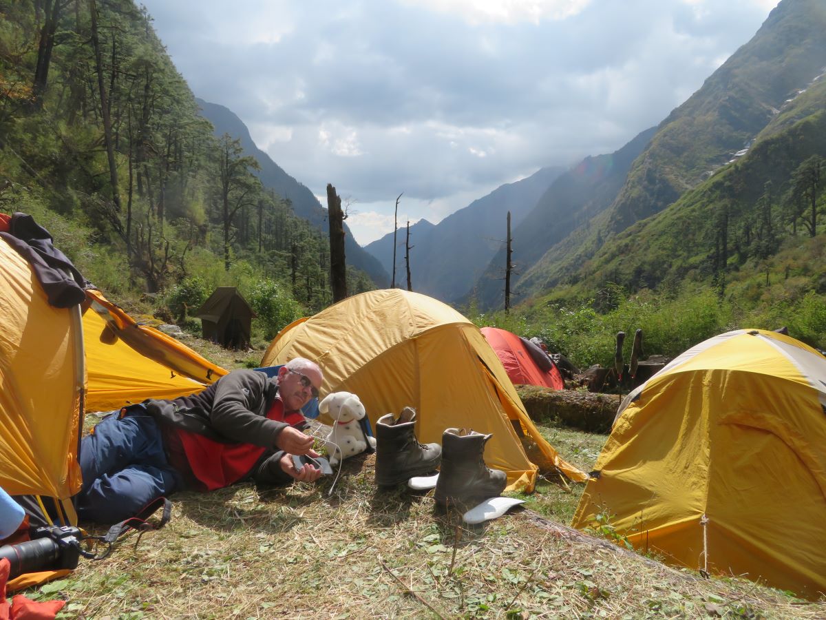
It was only a half day today, lunch was served at our campsite instead of partway. We had a nice terraced campsite, quite small, with just enough room for us and the French team heading up. A lovely sunny afternoon was spent relaxing, with everything dragged out for drying. Partook in a bit of yoga with Anne, stretching out the legs and back.
Soligari to Italian Base Camp
- 2.5 miles
- 2.25 hours elapsed
- 500m total ascent (with 41m descent)
- Max elevation: 3610m (+450m)
- Nepali toilet
- Dinner: Soup, beef jerky/pasta/veg +peanut sauce, pineapple and momos, potato cakes and greens on day 2.
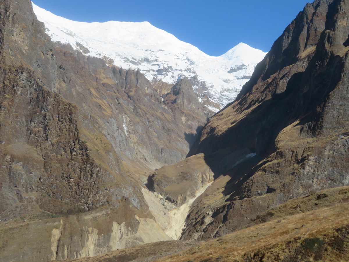
It was a late start today, as we only had a short walk. Again, there was a split, with myself and Gordon taking the relaxed way. More uphill, more woods, more stream crossing, a really lovely morning stroll. Italian Base camp is situated perfectly, in a bowl, with Dhaulagiri 1 behind and on the right and other smaller mountains on the left. It’s got a “lodge†and a permanent residence (which had satellite tv and solar electricity) and with sleeping rooms and terraces for camping. It also has a few toilets, so we had a brick building instead of a tent at this camp, that was going to be our home for the next two days.
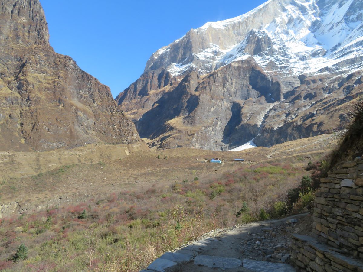
Our donkeys caught up with us today, bringing more provisions and the heavier mountaineering gear we’d left behind. Lunch, stretching and gear drying were the first things to happen, before Anne and I went for a small walk out along our route to the next camp. Down the slope behind the camp – and at the bottom we had a really hard time working out how we would get to the next part of the walk, given there was no obvious path across the glacier and a lot of the paths/steps on the other side of the river appeared to be covered by landslides. We’d find out in a couple of days.
Not the best night’s sleep, combination of altitude hitting and the donkeys sounding like they were wandering around all night very close to the tents! We had a planned lie in on the morning, but I was awake and up around 6:15, so sat and watched the light, as the sun hits the top of the mountains. The French team and a sole Spanish trekker headed out this morning, after only one night at camp, obviously on a far tighter schedule. We had a guide and 2 porters head out too, to make a drop of food and equipment at the next camp and to see what the conditions were like so we could make a go/no decision to carry on.
Our acclimatisation walk today was supposed to be a “gentle stroll” which basically consisted of heading straight up the side of Dhaulagiri to get a lot more altitude. An additional 350m added, up to 3960m.
In the afternoon, there was kit check for the rest of the group who were planning on tackling Dhampus and also a chat about the emergency kit and altitude. I volunteered to be the test subject for a demonstration of the Portable Altitude Chamber, which was definitely an interesting experience. You get zipped inside and they start inflating it until it becomes a hard, rigid shell. We used a barometric altitude watch which showed I’d dropped down the equivalent of 2100m. You have to keep pushing air into the PAC, because otherwise you’re in danger of asphyxiating from CO2 – I could definitely feel the impact as I started to yawn a lot.
One final dinner and off to sleep. it was about to get a lot harder from now one. We were heading through the pass.
You can find the full set of pictures on Flickr